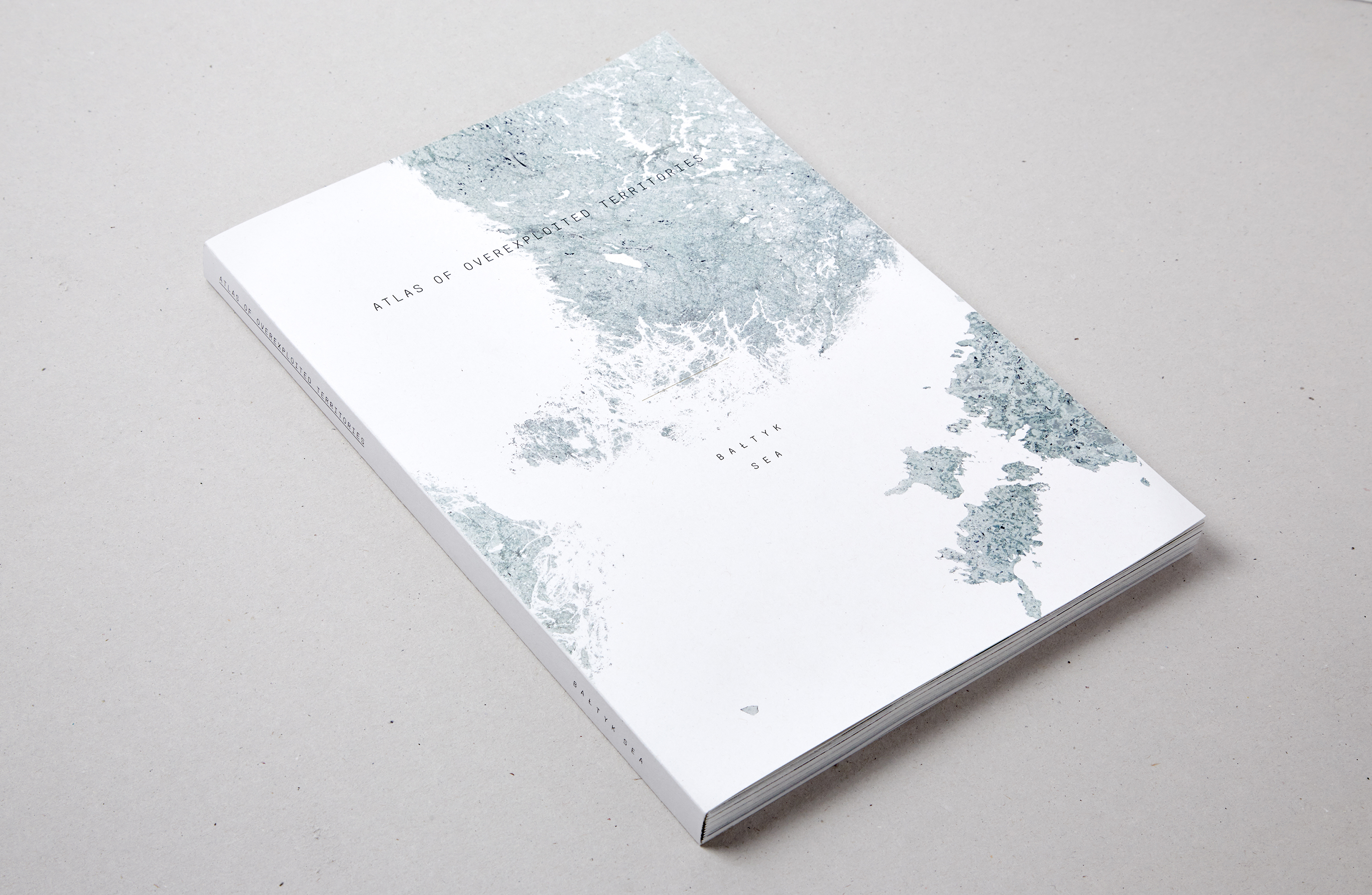
E01 Atlas of Overexploited Territories
Type of work: Master thesis
Context: Ecole Polytechnique Fédérale de Lausanne
Study period: 2015
Authors: Muriz Djurdjevic, Thomas Paturet
Teachers: Prof. Harry Gugger, Barbara Costa,
Prof. Luca Pattaroni, François Charbonnet
Photographies: Douglas Mandry
Awards: Best Master thesis
Exhibitions: La Biennale di Venezia 2016
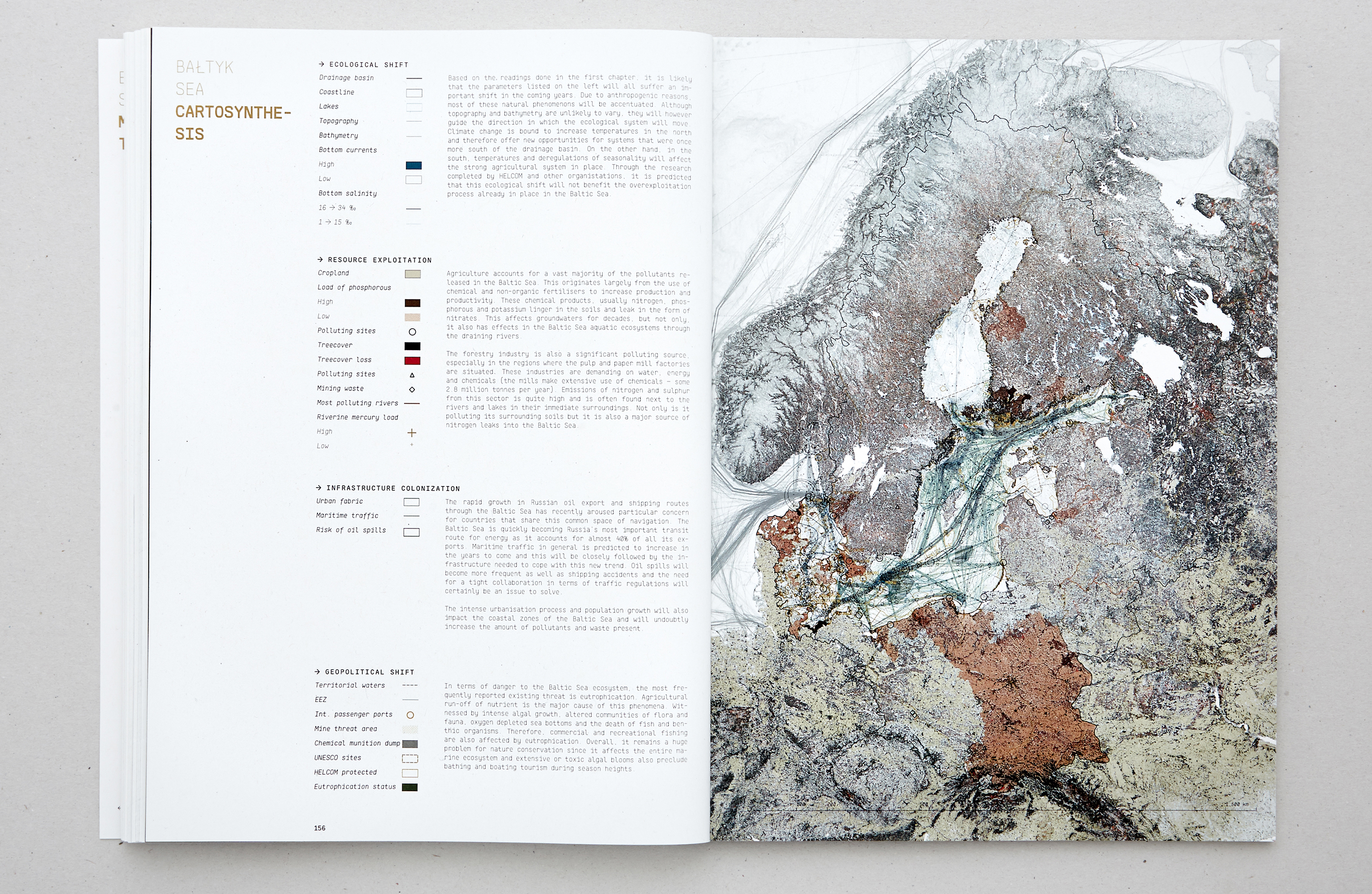
Shared maritime resources
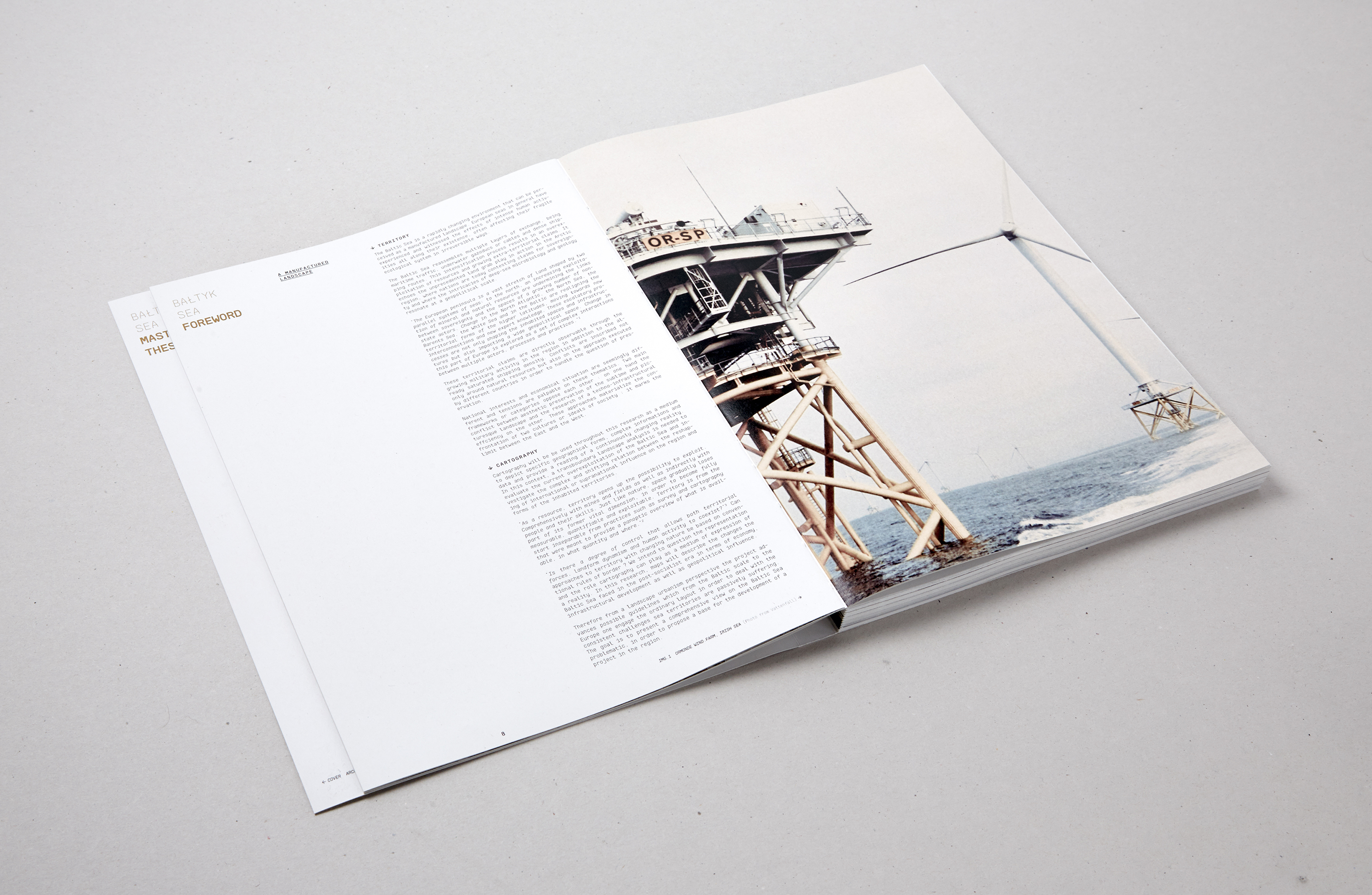
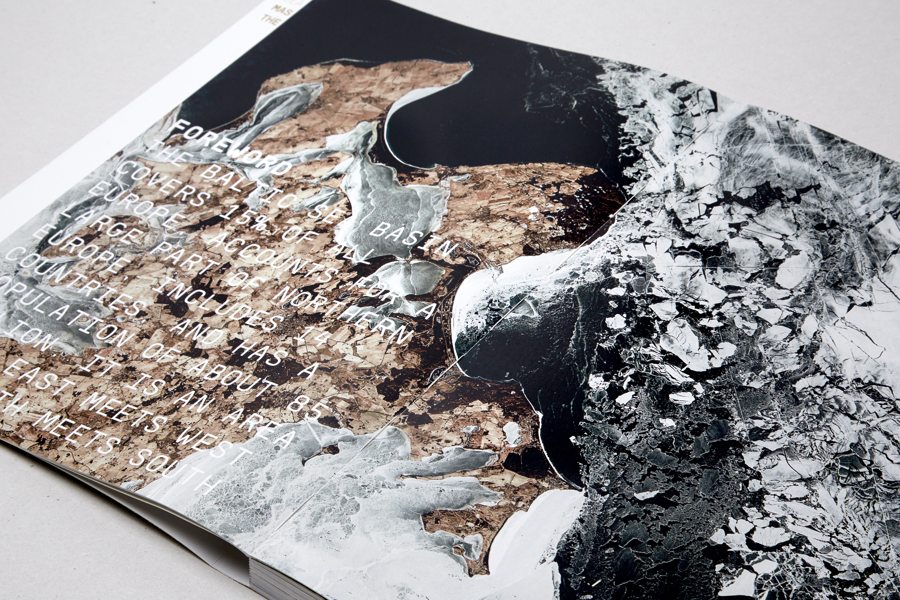
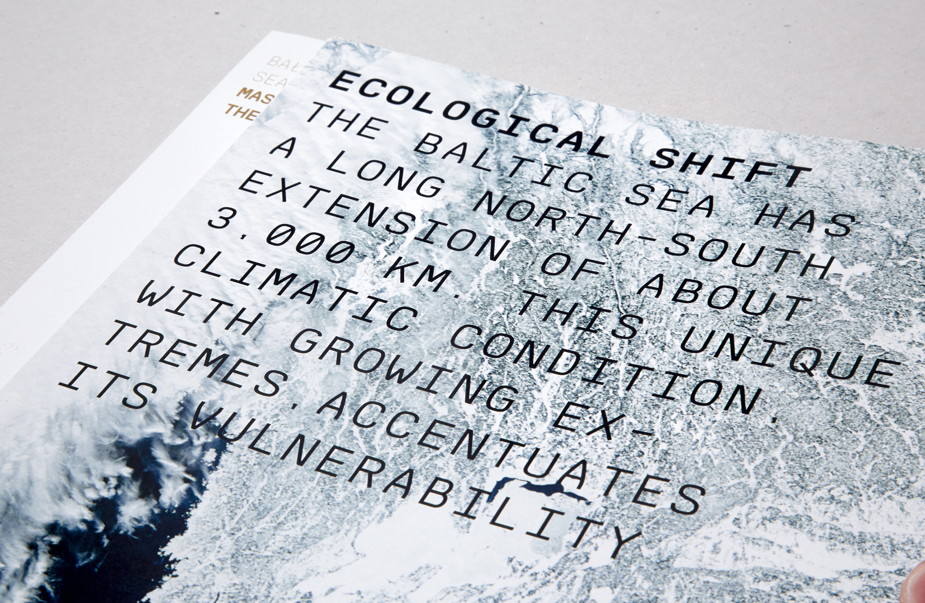
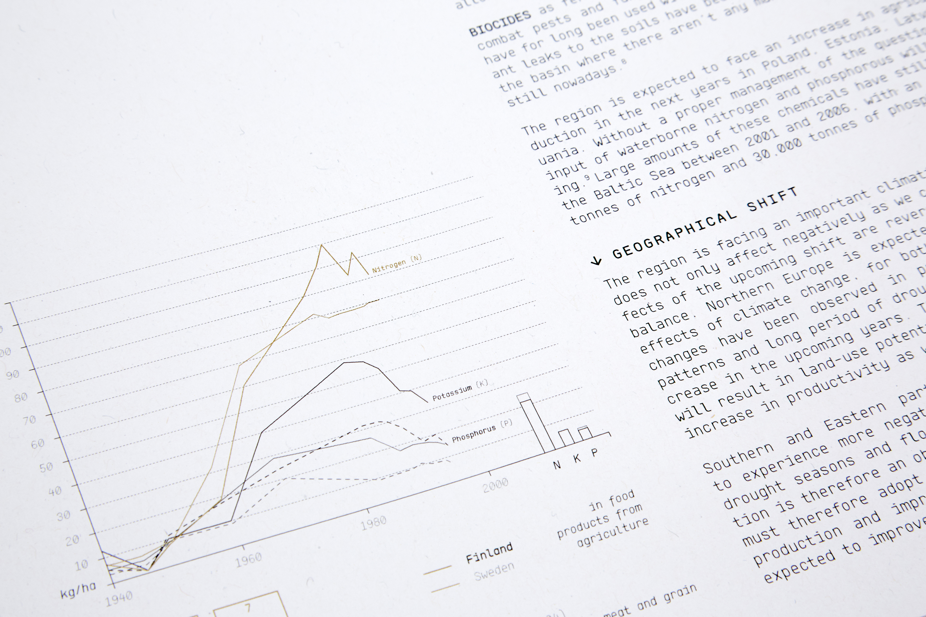
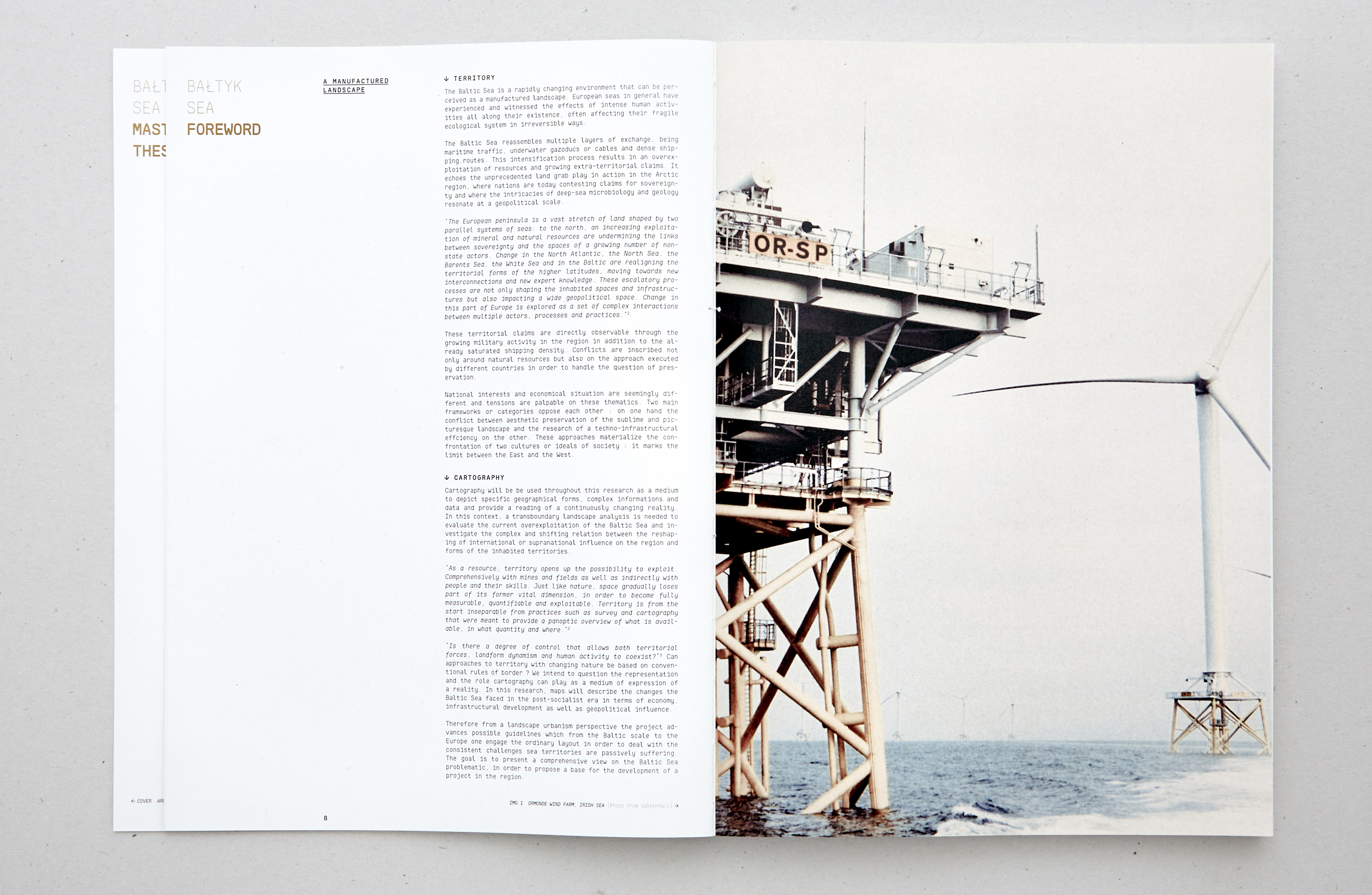
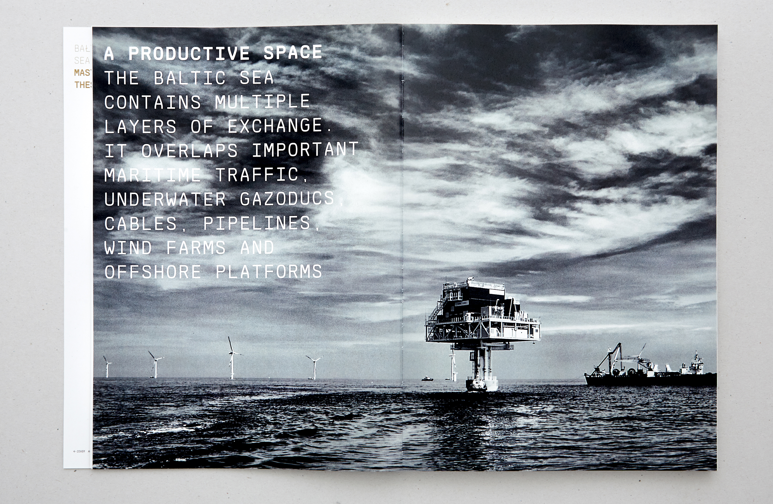
The Baltic Sea is a rapidly changing environment that can be perceived as a manufactured landscape. European seas in general have experienced and witnessed the effects of intense human activities throughout their existence, often affecting their fragile ecological systems irreversibly. The Baltic Sea brings together multiple layers of trade, from maritime traffic, gas pipelines and submarine cables to dense shipping routes. This process of intensification is reflected in the overexploitation of resources and growing extraterritorial claims. It echoes the unprecedented land grabbing game in action in the Arctic region, where nations are now fighting over sovereignty claims and where the intricacies of deep-sea microbiology and geology resonate on a geopolitical scale.
A territory under high tension
"The European peninsula is a vast expanse of land shaped by two parallel sea systems: to the north, increasing exploitation of mineral and natural resources is challenging the links between sovereignty and the spaces of a growing number of non-state actors. Changes in the North Atlantic, North Sea, Barents Sea, White Sea and Baltic Sea are realigning the territorial forms of the higher latitudes, moving towards new interconnections and new expertise. These escalating processes are not only shaping inhabited spaces and infrastructures, but also impacting on a vast geopolitical space. Change in this part of Europe is explored as a set of complex interactions between multiple actors, processes and practices." These territorial claims are directly observable through the increasing military activity in the region, in addition to the density of shipping saturated by al-ready. The conflicts are not only about natural resources but also about the approach taken by different countries to manage the issue of preservation. National interests and economic circumstances are apparently different and tensions are palpable on these issues. Two main frameworks or categories are opposed: on the one hand the conflict between the aesthetic preservation of the sublime and picturesque landscape and on the other hand the search for techno-infrastructural efficiency. These approaches materialise the confrontation of two cultures or ideals of society: it marks the limit between East and West.
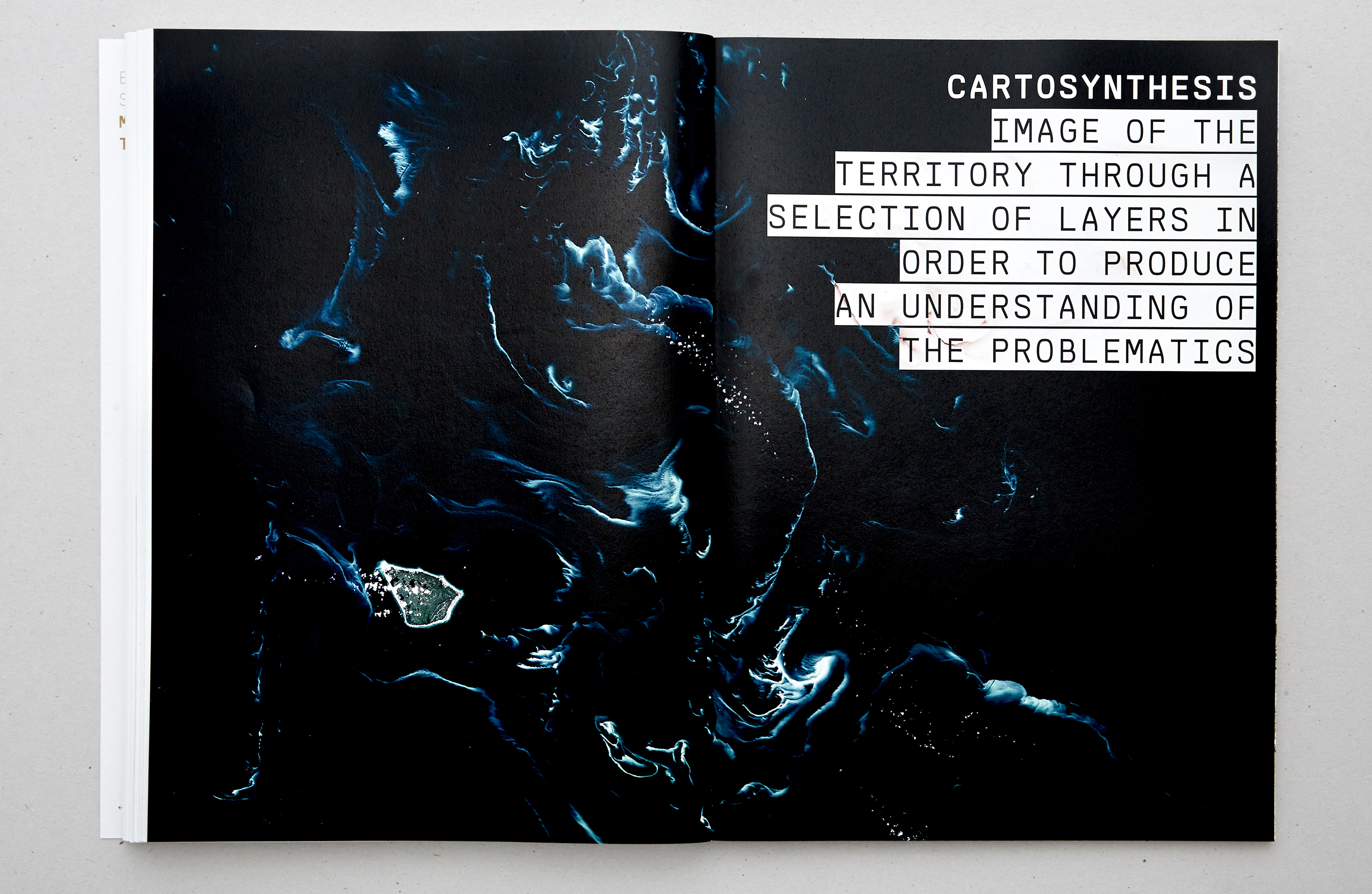
Cartography as a method
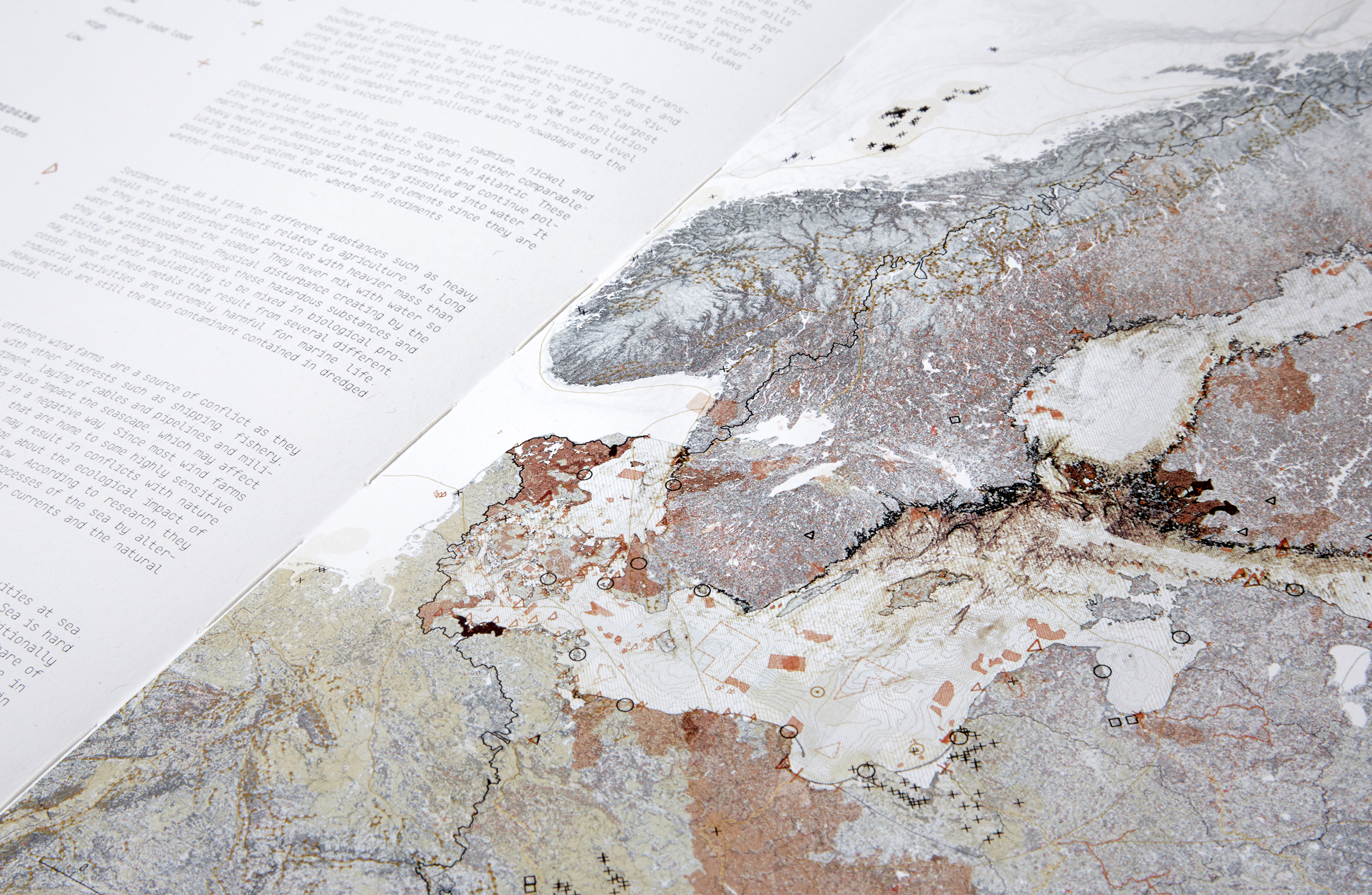
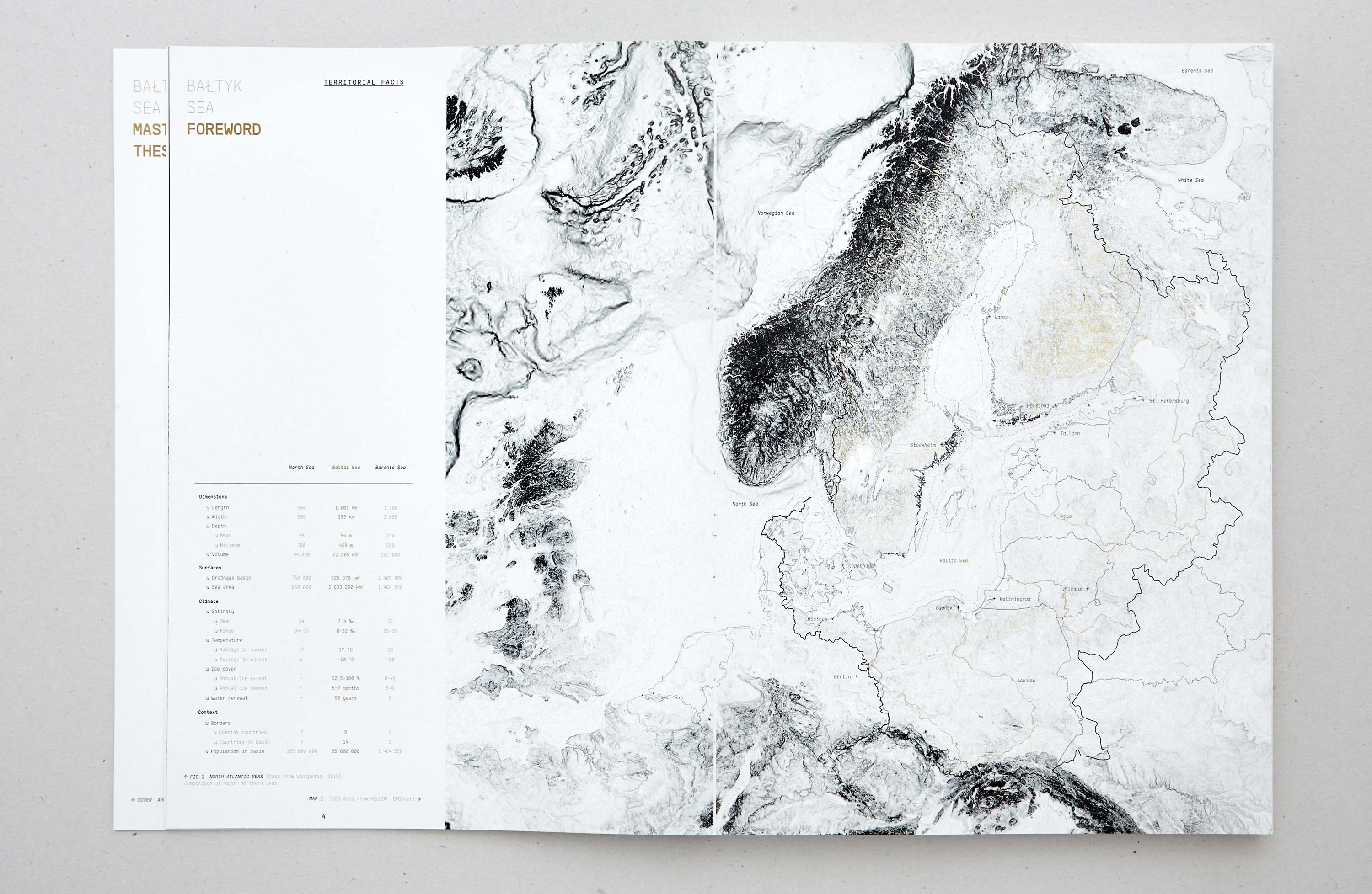
Cartography will be used throughout this research as a means of representing specific geographical forms, information and complex data and of providing a reading of a constantly changing reality. In this context, an analysis of the cross-border landscape is necessary to assess the current overexploitation of the Baltic Sea and to study the complex and changing relationship between the reshaping of international or supranational influence on the region and the forms of inhabited territories. As a resource, the territory offers the possibility of being exploited. Globally with mines and fields, but also indirectly with people and their skills. Like nature, space is gradually losing part of its former vital dimension, to become fully measurable, quantifiable and exploitable.
Territory and representation
"Territory is, from the outset, inseparable from practices such as surveying and mapping, which are supposed to provide an overview of what is available, how much and where. We intend to question the representation and the role that cartography can play as a means of expressing a reality. In this research, the maps will describe the changes that the Baltic Sea has faced in the post-socialist era in terms of economy, infrastructure development and geopolitical influence. Therefore, from the perspective of landscape urbanism, the project proposes possible guidelines that, from the scale of the Baltic to that of Europe, engage ordinary planning in order to face the constant challenges that maritime territories passively undergo. The aim is to present a global vision of the Baltic Sea problematic, in order to propose a basis for project development in the region.
Type of work: Master thesis
Context: Ecole Polytechnique Fédérale de Lausanne
Study period: 2015
Authors: Muriz Djurdjevic, Thomas Paturet
Teachers: Prof. Harry Gugger, Barbara Costa,
Prof. Luca Pattaroni, François Charbonnet
Photographies: Douglas Mandry
Awards: Best Master thesis
Exhibitions: La Biennale di Venezia 2016
Shared maritime resources
The Baltic Sea is a rapidly changing environment that can be perceived as a manufactured landscape. European seas in general have experienced and witnessed the effects of intense human activities throughout their existence, often affecting their fragile ecological systems irreversibly. The Baltic Sea brings together multiple layers of trade, from maritime traffic, gas pipelines and submarine cables to dense shipping routes. This process of intensification is reflected in the overexploitation of resources and growing extraterritorial claims. It echoes the unprecedented land grabbing game in action in the Arctic region, where nations are now fighting over sovereignty claims and where the intricacies of deep-sea microbiology and geology resonate on a geopolitical scale.
A territory under high tension
"The European peninsula is a vast expanse of land shaped by two parallel sea systems: to the north, increasing exploitation of mineral and natural resources is challenging the links between sovereignty and the spaces of a growing number of non-state actors. Changes in the North Atlantic, North Sea, Barents Sea, White Sea and Baltic Sea are realigning the territorial forms of the higher latitudes, moving towards new interconnections and new expertise. These escalating processes are not only shaping inhabited spaces and infrastructures, but also impacting on a vast geopolitical space. Change in this part of Europe is explored as a set of complex interactions between multiple actors, processes and practices." These territorial claims are directly observable through the increasing military activity in the region, in addition to the density of shipping saturated by al-ready. The conflicts are not only about natural resources but also about the approach taken by different countries to manage the issue of preservation. National interests and economic circumstances are apparently different and tensions are palpable on these issues. Two main frameworks or categories are opposed: on the one hand the conflict between the aesthetic preservation of the sublime and picturesque landscape and on the other hand the search for techno-infrastructural efficiency. These approaches materialise the confrontation of two cultures or ideals of society: it marks the limit between East and West.
Cartography as a method
Cartography will be used throughout this research as a means of representing specific geographical forms, information and complex data and of providing a reading of a constantly changing reality. In this context, an analysis of the cross-border landscape is necessary to assess the current overexploitation of the Baltic Sea and to study the complex and changing relationship between the reshaping of international or supranational influence on the region and the forms of inhabited territories. As a resource, the territory offers the possibility of being exploited. Globally with mines and fields, but also indirectly with people and their skills. Like nature, space is gradually losing part of its former vital dimension, to become fully measurable, quantifiable and exploitable.
Territory and representation
"Territory is, from the outset, inseparable from practices such as surveying and mapping, which are supposed to provide an overview of what is available, how much and where. We intend to question the representation and the role that cartography can play as a means of expressing a reality. In this research, the maps will describe the changes that the Baltic Sea has faced in the post-socialist era in terms of economy, infrastructure development and geopolitical influence. Therefore, from the perspective of landscape urbanism, the project proposes possible guidelines that, from the scale of the Baltic to that of Europe, engage ordinary planning in order to face the constant challenges that maritime territories passively undergo. The aim is to present a global vision of the Baltic Sea problematic, in order to propose a basis for project development in the region.